
We picked up highway 20 out to Willits, and after a short jog south, continued east. Any further south would have taken us right into the Kincade fire zone in Sonoma county. At Williams, we rather reluctantly hooked onto the I-5 down as far as Sacramento, before veering east again on 50. Fuel was topped off at Placerville around dusk. After encountering very heavy oncoming traffic as we climbed into the Eldorado National Forest, we managed to locate Sand Flats FS campground. It was immediately adjacent to the highway, but the traffic noise eventually died down, as did the temperatures at that higher elevation.

To take advantage of the better prices for fuel ($3.10/g diesel) and beverages, we made a short detour northward to Gardnerville, Nv, before returning thrrough Alpine Village and Markleeville, then taking Monitor Pass back towards 395.


Following 395 south into the eastern sierra is very scenic and the traffic was very light, so we made it into Bridgeport in good time. We recalled that the diesel price last year was $4.79, but it seems it has gone up just a bit!

Fortunately, the tank was full, as were my two spare fuel cans at this point. Our destination was Travertine hot springs, just outside of town. The road up to my preferred camp spot is rather rough, and I'd rather not do it, only to find my spot taken. That's where the UAV (drone to some folks) comes in handy! I sent it up to check the area, and found that sure enough, my spot was vacant. I always try to avoid arriving on a weekend as well.


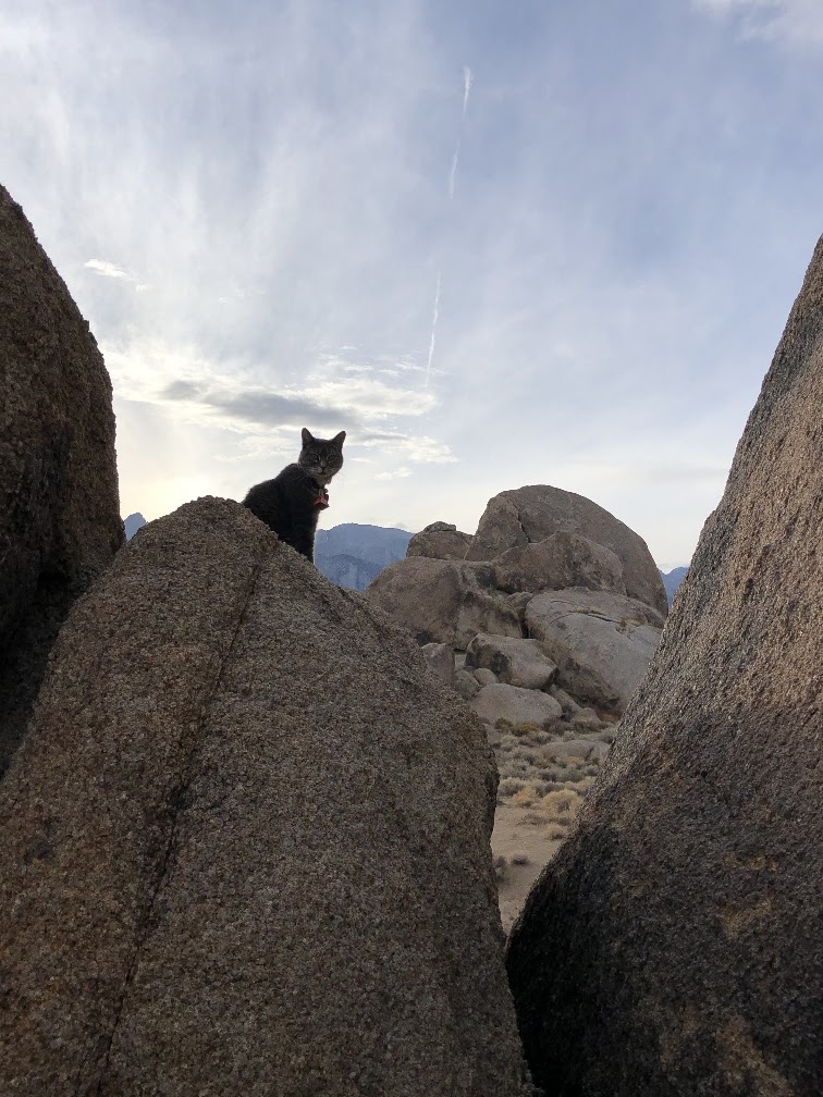
Hailey quickly got back into re-training all the local chipmunks, and whatever real or imaginary creatures lurked under the bushes!
We hadn't really planned to stay that long, but the long weekend snuck up on us, and I had no desire to face any increased traffic on the road, or at the next proposed stop at hot springs down near Mammoth.
Went for what was planned to be just a short exploration up Aurora Canyon road, leading right out of Bridgeport. But, as usual, it lured us further and further, and higher and higher, till we had a nice view back over the valley, and could see that the road seemed to join up with the Bodie - Masonic road. The road was even fairly smooth - in a few places! We picked up the Bodie road at the junction, and seven miles later, the ghost town of Bodie came into view.


After the long weekend was over, it seeemed advisable to carry on. Got the propane topped off in Lee Vining, and headed for the hotsprings near Mammoth. Having just spent a week in hot water at Travertine, it was not that important to hit these springs as well. But once again, it was decided to check out the parking and such before committing to the dusty road. Good thing we did, too. It turns out that the BLM have been busy maintaining and controlling the area. The spot I usually park with my 5er is now all blocked with rocks, so that it is a turn-around only :-( Good thing I didn't drive all the way in to discover that!


 | ||||||
| Trail and wooden walkway down to the pools. |
 |
| Pools at Wild Willy's |
With lots of flight time available, we checked out nearby Hilltop springs on the return. This is a fairly small, concrete tub, but the view around is 360, and there is a handy tap so you can turn the heat up and down as you like.


| Not my photo! |


 |
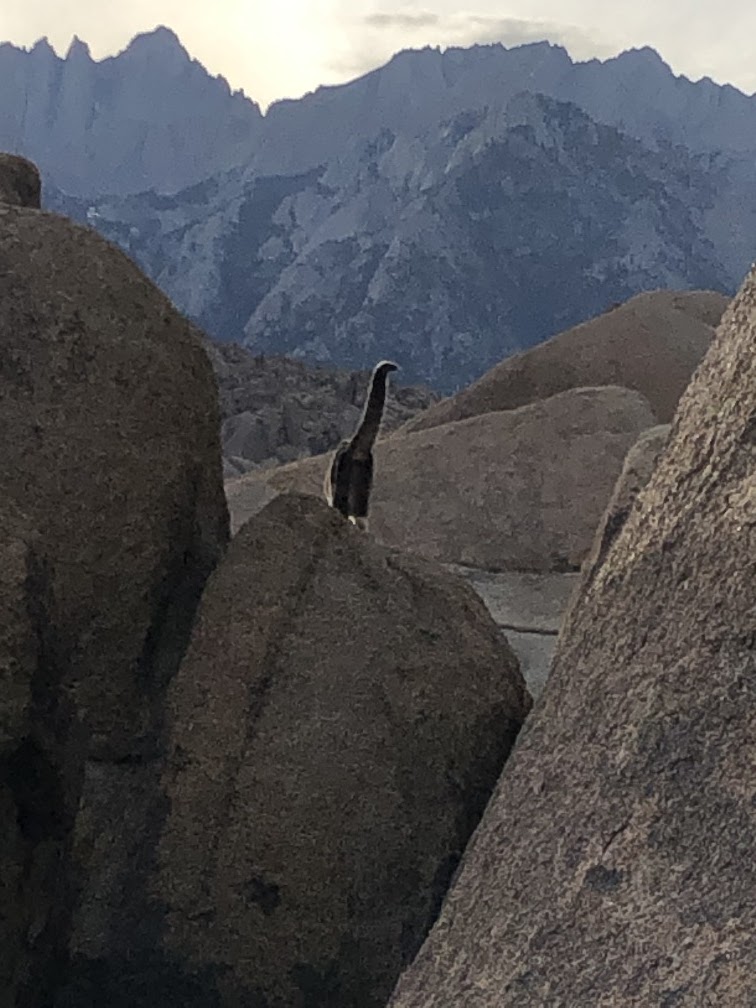
| Zoom in - she's up there! |
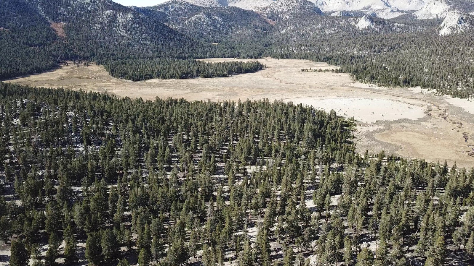
As usual, we made a day trip up to Cottonwood Meadows area, from the 4600' level in our camp to over 10,000' up at the meadows. Previously, we hiked up to Cottonwood Pass, at over 11,000', but the wind was blowing up there and it was chilly, though sunny and nice.

There seems to be some confusion on the road up there. Do I park on the pavement, or not?


Maybe John & Brenda, too, as soon as their rig gets out of hospital after an unplanned encounter on their last excursion. Glad no one was hurt.
Till next time!
Oh Dear those pics of the Alabama Hill sure tugged at me. We were only there once years ago and I had always hoped to make it back there again. What a great area all around there. Looks like Hailey the Mountain Goat has adopted very well to her triangular mode of transportation. Good for you in sticking with her and enabling her to enjoy these great traveling days. Travels for us this winter are looking doubtful but we haven't given up. Enjoy your days:))
ReplyDeleteThanks Al. Never give up!
ReplyDeleteThe reports are encouraging, and our tentative plan is to find a weather window, that fits our escape plan from winter, but not probably till just before that jolly old elf is scheduled to make his southerly run. Maybe we can help him bring his load south.
ReplyDeleteBetter get studded tires on the rig, just in case!
DeleteGlad you stopped at the Alabama Hills. As of March 2019 it is now officially the Alabama Hills Nation Scenic Area. Altho Tuttle Creek and Portagee Joe are said to be the only authorized overnight areas, it's nice to see you found dispersed camping is still allowed. Looks like you're having a great trip
ReplyDeleteNo new signage, and no changes that I can see. No water or dump site in Tuttle - for the winter, I guess. It was very quiet, till the weekend, then tons of climbers and a few noisy, dusty atv's! All good.
ReplyDelete