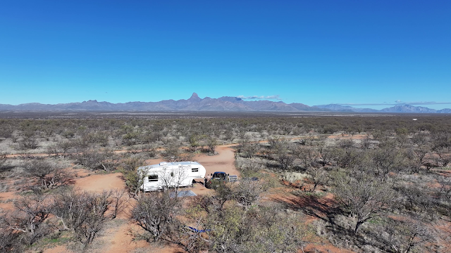
After about a week in Buenos Aires National Wildlife Refuge south west of Tucson, we headed east and soon found ourselves at another favourite camp spot in Las Cienegas National Conservation Area.
We cut through the southern edge of Tucson on the way to pick up an Amazon package at one of their convenient lockers at the Circle-K.
The weather was not the best, and there was rain, and even some lightning and thunder as we got to our hilltop spot with the great view. Luckily, the roads were not that greasy and it was not a problem. Soon after, a bit of a rainbow showed up.
There was another camper about a 1/2 mile away, but they soon pulled out, so we were able to maintain adequate separation!
Both Buenos Aires (managed by the US Fish & Wildlife Service), and Las Cienegas (managed by BLM) have cattle roaming freely, but they don't bother anyone.
You gotta watch this video!!!
You can see snow on Mt Wrightson in the background, after the recent lower level rain.
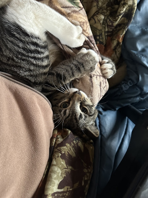
Mr Bailey is getting bigger by the day, and fitting right in with the lifestyle. His level of stress is evident!
As well as cattle, there are antelope roaming.
Night time critter action!
Look carefully, and you can see Orion in this night shot of the sky
Or, a direct link to the spot where he pulls into 'my old' camp spot >
Well, another week passed, and it was time to move on again. Before leaving the historic ranch headquarters, I topped off the water supply, and it was a good thing I did. When I stopped in Gila Bend to use the free RV dump there, the water taps were dry - even though I had used them a few weeks prior. But I emptied the tanks that needed emptying, and used a jug of non-potable water I carry to rinse out the hose!
The loose plan had been to maybe make it to Bouse or Quartzsite for the night, but it was getting late, and I had to watch a hockey game online. So, we ended up stopping at Saddle Mtn BLM for the night. It's been a few years since I stayed there, so picked the wrong entrance road. The only decent spot was covered in trash - looked like a homeless person had been there (?), but I picked up a bag full of it in the morning before we left. I don't think I even took a photo for that quick overnight.
The next day, after perusing the maps and Google, we avoided the I-10 and took the shortcut Salome Rd, then Eagle Eye Rd up to Aguila. Looks like there may be some decent boondocking options along the north end of Eagle Eye road, though I was getting very little cell service (more on that later). From there it was up highway 93 (the future 111 interstate), which is very busy and quite rough. At Burro Ck we roughed our way into our usual spot on the cliffs across the creek from the BLM campground!
I knew from the past that cell service was spotty there, but I was still a bit surprised when my AT&T hotspot with a MIMO antenna picked up nothing. Then, I discovered that my phone had been locked onto AT&T while near the Mexico border, to prevent it locking onto a Mexican cell tower. When I released it, I had 4 bars of 5G on both T-Mobile and Verizon, both of which my Canadian Rogers phone seems happy to use! I guess my AT&T hotspot only uses 4G towers from AT&T, so it was handicapped? And then I noticed that I could actually see two cell towers to the north of camp!
One of the my main reasons for going to Burro Ck, is the nearby Kaiser Hot (warm) Springs!
Art work under the bridge ...You park under the highway bridges, and hike about a mile down the wash to get there. On a previous visit, there were some 'no trespassing' signs before the springs because of some mining exploration in the area, but those are long gone now, and someone had made a few minor improvements to the springs themselves!
Spotted these exploratory mine works, just past the springs.

I took this photo of my truck parked under the overpasses, from over a mile away at the hot spring, using the incredible magnification on my latest drone. Below, is where that photo above was taken from, under normal magnification! You can just make out the bridges in the distance.
Don & Donna, who were staying in Lake Havasu area, met up with me in Kingman for lunch one day, then Anders & Dianne talked me into joining them on Lake Mohave, at Nevada Telephone Cove for a few days.
We day-tripped up to Six Mile Cove further up the lake one day, and I was surprised to find no campers or kite boarders there, despite the substantial winds! I spent a week here back in November.
We met up with Don & Donna again for Happy Hour in Laughlin one day.
Sadly, we got the news that John, of John & Brenda's Incredible Journey suffered a fatal heart attack, likely while he was out enjoying his usual morning stroll with his camera, in the mountains east of Apache Junction. Our thoughts and condolences go out to Brenda, and John's family :-(
I was glad I got to visit with them both and share a meal back in December while they were camped nearby.
This blog post is getting long enough, so I won't even tell you where we've moved to now. You'll just have to wait and watch for the next post - whenever I get around to it! Cheers!


